
Originally posted at CALmatters.
By Julie Cart.
As glaciers melt and oceans warm, experts say the Pacific waters surrounding California are now rising 30 to 40 times faster than in the last century. The surge—driven by global climate change—will gobble up beachfront and overwhelm coastal cities. A recent U.S. Geological Survey report estimated that up to two-thirds of Southern California beaches could vanish within this century.
No stretch of the state’s 3,400 miles of coast, bays, inlets and islands will be spared. Inland areas will flood more regularly and more deeply, as warmer waters spawn more intense storms and the swollen sea pushes farther onshore, unimpeded. Erosion from more powerful waves already is working away at bridge footings, undermining spans that are critical to transportation corridors, which themselves are strung along the California coast.
Addressing sea-level rise will cost a staggering sum of public and private money, and will particularly impact the poor and vulnerable. A look at the challenge California faces, and how the state is responding.
- Why does climate change accelerate sea-level rise?
- How bad is it going to get in California?
- What parts of the state will be hardest hit?
- How is the state of California responding to sea-level rise?
- What are some of the ways to protect the coast?
- Sounds expensive—what will this cost?
- Where can I learn more about this?
WHY DOES CLIMATE CHANGE ACCELERATE SEA-LEVEL RISE?
It’s really about how heat creates energy. The planet’s seas are warming, which means that water molecules are bouncing around and expanding, increasing the volume of water. And water has a tremendous capacity to retain heat, absorbing more than 90 percent of the warming atmosphere.
Scientists say that even if every nation stopped emitting carbon today, the oceans’ residual heat would continue to cause sea-level rise.
More critically, all the warm water is contributing to the alarming acceleration of polar ice melt. Both Antarctica and Greenland are losing ice sheets and glaciers, and the trillions of tons of ice a year are adding to the volume of water.
HOW BAD IS IT GOING TO GET IN CALIFORNIA?
Dozens of reports predict—as best as scientists can—the level of sea rise and the expected timeframe. Another factor is the speed at which carbon-reduction policies can achieve their goals. It’s difficult work and hardly precise.
But the most recent scientists’ report for the state of California’s Ocean Protection Council offers the best look at the possibilities, offering a range of scenarios and assigning probabilities to the projections. For example, if officials do everything humanly possible to prepare for sea-level rise, there is still a 67 percent probability that the San Francisco Bay Area will experience sea rise between 1 foot and 2.4 feet by 2100. Absent any response, that range increases to 1.6 to 3.4 feet.
Scientists often explain that the Pacific Ocean is not a bathtub — the sea will rise at different rates in different places, dictated by variants such as the presence of seawalls, wetlands and the shape of the ocean floor. The actual rate of rise is very much a local phenomenon. Overall, though, the report concludes that if nothing is done to slow global warming, the Pacific Ocean will rise 10 feet along the California coast, a rate of rise that is 30 to 40 times faster than the previous century.
WHAT PARTS OF THE STATE WILL BE HARDEST HIT?
Sea-level rise is an equal-opportunity disaster, touching the coasts, bays, rivers and the Sacramento San Joaquin Delta. Other parts of the state will experience collateral damage associated with transportation interruptions and infrastructure damage.
Experts often zero in on the Bay Area, both for its vulnerability and for the density of its population and built environment. Most sea-level rise scenarios suggest that the international airports in San Francisco and Oakland are at extreme risk of flooding, as is the busy port of Oakland.
In Sacramento, the state capital already defended from flooding by a series of levees that may not continue to hold, and, to the south, the Delta’s delicate water system is in danger of being overwhelmed.
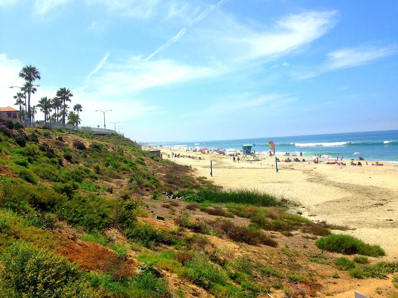
In the far north of the state, officials are considering how to safeguard bridges and coast-hugging highways such as Highway 1. To the south, where entire cities such as Huntington Beach are huddled along low-lying beaches, officials will have to consider either a shoreline retreat or elevating buildings.
HOW IS THE STATE OF CALIFORNIA RESPONDING TO SEA-LEVEL RISE?
Measuring and projecting sea-level rise along California’s 1,100-mile coast has been a priority for the state at least since 2008, when then-Gov. Arnold Schwarzenegger issued an executive order directing all state agencies include an adaptation strategy in all planning and permitting documents.
Gov. Jerry Brown reaffirmed that in 2010 and asked for an update to the scientific projections.
That report was prepared by the Ocean Protection Council, the state agency that coordinates the government’s coastal programs. It was released in April and set out the direst projections yet: The Pacific could rise as much as 10 feet in California in the next 80 years, covering up 800 feet of existing beach.
The state Legislature has also identified the problem, producing its own various reports. One termed sea-level rise as a “slow-moving emergency.” Still, it falls to lawmakers to find the money to fund the myriad mitigation projects required.

State agencies, as well as cities and counties, are now incorporating that new data into zoning decisions —where public and private projects can be placed and, in some cases, how they are built. The idea is to not allow building in areas that are subject to more serious temporary flooding or are projected to be permanently under water in the future.
Building codes are likely to change, with laws mandating more-flood resistant design and modifications such as moving critical power-plant facilities out of basements and lower floors.
Finally, the California Coastal Commission, which has permitting authority in coastal areas, is working with local governments, homeowners and others to ensure that new construction is built to last on a site that is safe.
WHAT ARE SOME OF THE WAYS TO PROTECT THE COAST?
There are a number of mechanisms to defend the coast and structures along it and, usually, there is not one ‘right’ way to do that.
Broadly, there are three categories—protection, accommodation and retreat—each with its own benefits and limitations.
Protection, also known as armoring, involves erecting physical barriers such as seawalls, levees and artificial reefs. These are intended to keep rising seas and floodwater at bay and also protect beaches and coastal bluffs from erosion from waves.
There is a counter-intuitive side effect to sea walls, for example. Wave action can wear away at a beach and erode it. But waves are also responsible for beach replenishment, dumping sand on shore with each arrival. Too, armoring one section of the coast can mean more pounding to its neighbor, as the mechanics of wave actions seek release.
In addition to so-called ‘hard armoring,’ there are more natural methods, such as restoring wetlands and marshes to absorb water and slow storm surges. These strategies are being used in parts of the San Francisco Bay.
Accommodation is the broadest category. This means learning to live with a certain amount of sea-level rise by elevating structures and addressing flooding through the use of tide gates. It allows development to remain where it is without the need for a wall. Some counties are considering building codes that call for structures to be elevated.
This is often the option for roads, which retain their footprint but are raised above an anticipated flood level.
Retreat is often the last resort. In some instances, it means abandoning the shore for higher ground, taking structures with you or leaving them behind. What officials like to call ‘managed retreat’ is the more palatable idea, planning ahead for relocation rather than fleeing in front of onrushing water. State officials are already moving roads and other infrastructure.
Most major projects around the state will likely require a mix of approaches.
SOUNDS EXPENSIVE—WHAT WILL THIS COST?
The short answer is that no one knows. The problem is immense, spans much of California and straddles the public and private sector. So that’s two sets of unknown estimates.
And, since most state and local agencies have yet to fully identify the most urgent projects, we are a long way from coming up with anything like a grand total. It’s going to play out in an unending series of mega-projects — bridge rebuilding, highway retrofitting, moving power plants and water treatment facilities —and the cost is going to be in the trillions of dollars.
It’s always more expensive to redo major projects than it is to build them with sustainability and adaptability in mind. One expert’s rough calculation to protect just the San Francisco Bay with a simple levee—not accounting for any relocating, rebuilding or constructing any other more sophisticated defensive measures? As much as $100 billion.
And, consider this rule of thumb in the disaster response world: The cost of cleaning up a mess is four times what it would have been to fix it ahead of time.
WHERE CAN I LEARN MORE ABOUT THIS?
CALmatters has an ongoing series exploring the impacts of climate change in California:
- Part 1: California submerging
- Part 2: Shoring up the state
- Shifting sands
- Part 3: Battling rising seas, Louisiana ‘gets on with it’—minus California-style climate talk
Here is a list of recent reports about climate change in California and how the state is preparing:
- The 2017 sea-level science report to the California Ocean Protection Council
- The 2017 report by the U.S. Geological Survey on Southern California beaches
- The 2015 climate change report of the state Senate Committee on Environmental Quality
- The 2014 legislative report of the Assembly Select Committee on Sea Level Rise and the California Economy
- The 2012 report to the California Energy Commission on San Francisco Bay impacts