


By John Taylor.
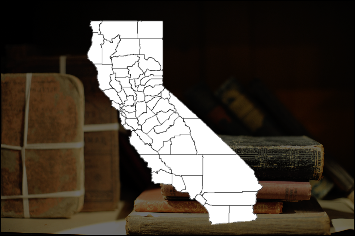
One hundred and fifty years ago, the first gathering of the California Legislature divided the state into 27 counties. Over the next 57 years, the state’s territory was further subdivided and county boundaries were changed to create the names and places we recognize today.
It could be said that the history of California’s counties began when the “Treaty of Peace, Friendship, Limits, and Settlement between the United States of America and the Mexican Republic” was signed on Feb. 2, 1848. The treaty ended the Mexican War and placed California under jurisdiction of the United States. Better known as the treaty of Guadalupe Hidalgo, it was named after the city, near Mexico City, where it was signed. Treaty copies were subsequently exchanged and ratified in the Mexican city of Queretaro on May 30, 1848, and the treaty was proclaimed by President James K. Polk on July 4, 1848.
California’s first constitutional convention was held in Monterey, starting in September 1849. Delegates came from ten districts: San Diego, Los Angeles, Santa Barbara, San Luis Obispo, Monterey, San Jose, Sonoma, San Francisco, San Joaquin, and Sacramento.
This constitutional convention established a committee, chaired by General Mariano Vallejo, that considered the creation of California’s first counties. On Jan. 4, 1850, the committee recommended the formation of 18 counties. They were Benicia, Butte, Fremont, Los Angeles, Mariposa, Monterey, Mount Diablo, Oro, Redding, Sacramento, San Diego, San Francisco, San Joaquin, San Jose, San Luis Obispo, Santa Barbara, Sonoma, and Sutter.
FIRST COUNTIES FORMED
The first session of the California Legislature was held from Dec. 15, 1849, to April 22, 1850, at the City of Pueblo de San Jose. Based, in part, on further recommendations from General Vallejo’s committee, the Legislature made additions and changes to the list of 18 counties.
Nine more counties were added to the proposal-Branciforte, Calaveras, Coloma, Colusi, Marin, Mendocino, Napa, Trinity, and Yuba-bringing the total number of original counties to 27.
Before it finally adopted a statute, the state Legislature approved several name changes. Benicia was renamed Solano, Coloma became El Dorado, Fremont transformed into Yola, Mt. Diablo became Contra Costa, San Jose was renamed Santa Clara, Oro shifted to Tuolumne, and Redding became Shasta.
Following these additions and name changes, the state’s first counties were created by an Act signed Feb. 18, 1850. In summary, the first 27 counties were Butte, Branciforte, Calaveras, Colusi, Contra Costa, El Dorado, Los Angeles, Marin, Mariposa, Mendocino, Monterey, Napa, Sacramento, San Diego, San Francisco, San Joaquin, San Luis Obispo, Santa Barbara, Santa Clara, Shasta, Solano, Sonoma, Sutter, Trinity, Tuolumne, Yola, and Yuba.
Not long after the Legislature adopted its first statute creating counties, subsequent statutes changed additional county names to those now familiar to us: Branciforte to Santa Cruz, Colusi to Colusa, and Yola to Yolo.
COUNTY SEAT STRUGGLES
On Sept. 9, 1850, California became one of 31 states in the union at that time. Proposals for many more counties were soon presented.
Particularly in the northern part of the state, fights arose within counties between mining districts and agricultural districts. Conflicts also developed in many counties over what community should be the county seat. Without paved roads, automobiles, and telephones, the distance from a home or business to a county seat was more important than it is now.
Some of these issues could often be partly resolved by dividing counties.In every one of the first seven years after 1850, at least one new county was created. Eighteen of the original 27 counties helped give birth to another county.
BOUNDARIES CONTINUE TO SHIFT
The California Legislature also created counties that are not found on today’s maps.
- Klamath County was created in 1851 from the northern half of Trinity County’s mostly mountainous mining country. In 1857 Klamath County, in turn, lost significant territory to the newly formed Del Norte County. In 1875, as charges of corruption in the county increased, Klamath County was abolished. Its territory was divided between Humboldt and Siskiyou counties. Territory that at one time was in Klamath County is now in Del Norte, Humboldt, Siskiyou, and Trinity counties.
- Pautah County was created in 1852 by an act that was to become effective when the United States Congress ceded to California territory in what is now Nevada. The county seat was to have been Carsonville. California never acquired the territory, and the act creating the county was repealed in 1859.
- Los Angeles County transformed from a small county along the coast to a large county extending to the Nevada border and then back again to being a relatively small county in area, although now it has about 29 percent of the state’s population.
- In 1850, Mariposa County was the largest in area of the original counties: It covered about a sixth of the state. It was larger than the present San Bernardino County, which is now the largest county in the country. Today’s Mariposa County is the parent or grandparent of all or parts of 12 other counties, more than produced by any other California county. Territory that at one time was in Mariposa County is now part or all of Fresno, Inyo, Kern, Kings, Los Angeles, Madera, Merced, Mono, San Benito, San Bernardino, San Luis Obispo, and Tulare Counties.
AN ALMOST IMPOSSIBLE TASK
In California’s early history it was relatively easy to create a new county. You simply had to convince the state Legislature. As a result, to the original 27 counties, 33 more were added, one of which (Klamath) died and one of which (Pautah) was never in California.
Today it is much more difficult to establish a new county. In 1894 the state constitution was amended to require uniform laws concerning county creation. In Sections 23320 through 23374, the California Government Code specifies the procedure: A favorable majority vote is needed both in the entire county affected and in the territory of the new county, an almost impossible task. As a result of the tougher laws with constitutional foundation, no new county has been formed since 1907, when Imperial County was created from eastern San Diego County, although it is still theoretically possible.
ADDITIONS TO AND SUBTRACTION FROM COUNTIES DURING BIRTH EVENTS
In this table, the left column shows the source of the territory when each county, listed in the middle column, was created. The right column shows the destination of the territory moved from one county to another at the time of the birth of a new county.
SOURCE OF TERRITORY |
COUNTY |
TERRITORY LATER GIVEN TO NEW COUNTIES |
| Contra Costa, Santa Clara 1853 | Alameda | |
| Amador, El Dorado, Calaveras, Tuolumne 1864 | Alpine | |
| Calaveras, El Dorado 1854 | Amador | Alpine 1864 |
| One of the original 27 counties 1850 | Butte | Plumas 1854; Tehama 1856 |
| One of the original 27 counties 1850 | Calaveras | Amador 1854; Alpine 1864 |
| One of the original 27 counties 1850 | Colusa | Tehama 1856; Glenn 1891 |
| One of the original 27 counties 1850 | Contra Costa | Alameda 1853 |
| Klamath 1857 | Del Norte | |
| One of the original 27 counties 1850 | El Dorado | Amador 1854; Alpine 1864 |
| Mariposa, Merced, Tulare 1856 | Fresno | Mono 1861; Madera 1893 |
| Colusa 1891 | Glenn | |
| Trinity 1853 | Humboldt | |
| San Diego 1907 | Imperial | |
| Mono, Tulare 1866 | Inyo | |
| Los Angeles, Tulare 1866 | Kern | |
| Tulare 1893 | Kings | |
| Trinity 1851 | Klamath | Del Norte 1857 |
| Napa 1861 | Lake | |
| Plumas, Shasta 1864 | Lassen | |
| One of the original 27 counties 1850 | Los Angeles | San Bernardino 1853; Kern 1866; Orange 1889 |
| “ | 1889 | |
| Fresno 1893 | Madera | |
| One of the original 27 counties 1850 | Marin | |
| One of the original 27 counties 1850 | Mariposa | Tulare 1852; Merced 1855; |
| “ | Fresno 1856; Mono 1861 | |
| One of the original 27 counties 1850 | Mendocino | |
| Mariposa 1855 | Merced | Fresno 1856 |
| Siskiyou 1855 | Modoc | |
| Calaveras, Fresno, Mariposa 1861 | Mono | Inyo 1866 |
| One of the original 27 counties 1850 | Monterey | San Benito 1874 |
| One of the original 27 counties 1850 | Napa | Lake 1861 |
| Yuba 1851 | Nevada | |
| Los Angeles 1889 | Orange | |
| Sutter and Yuba 1851 | Placer | |
| Butte 1854 | Plumas | Lassen 1864 |
| One of the original 27 counties 1850 | Sacramento | |
| Monterey 1874 | San Benito | |
| Los Angeles 1853 | San Bernardino | Riverside 1893 |
| One of the original 27 counties 1850 | San Diego | Riverside 1893; Imperial 1907 |
| One of the original 27 counties 1850 | San Francisco | San Mateo 1856 |
| One of the original 27 counties 1850 | San Joaquin | |
| One of the original 27 counties 1850 | San Luis Obispo | |
| San Francisco 1856 | San Mateo | |
| One of the original 27 counties 1850 | Santa Barbara | Ventura 1872 |
| One of the original 27 counties 1850 | Santa Clara | Alameda 1853 |
| One of the original 27 counties 1850 | Santa Cruz | |
| One of the original 27 counties 1850 | Shasta | Siskiyou 1852; Tehama 1856; |
| “ | Lassen 1864 | |
| Yuba 1852 | Sierra | |
| Shasta and Klamath 1852 | Siskiyou | Modoc 1855 |
| One of the original 27 counties 1850 | Solano | |
| One of the original 27 counties 1850 | Sonoma | |
| Tuolumne 1854 | Stanislaus | |
| One of the original 27 counties 1850 | Sutter | Placer 1851 |
| Butte, Colusa, and Shasta 1856 | Tehama | |
| One of the original 27 counties 1850 | Trinity | Klamath 1852; Humboldt 1853 |
| Mariposa 1852 | Tulare | Fresno 1856; Kern 1866; |
| “ | Inyo 1866; Kings 1893 | |
| One of the original 27 counties 1850 | Tuolumne | Stanislaus 1854; Alpine 1864 |
| Santa Barbara 1872 | Ventura | |
| One of the original 27 counties 1850 | Yolo | |
| One of the original 27 counties 1850 | Yuba | Placer 1851; Nevada 1851; Sierra 1852 |
[divider] [/divider]
Originally posted at the California State Association of Counties.
John Taylor is a retired clerk of the San Francisco Board of Supervisors and a past president of the California Clerk of the Board of Supervisors Association.