
 The City of Santa Barbara has released a Draft Sea-Level Rise Adaptation Plan for public review. The draft planidentifies areas of the City that are vulnerable to up to 6.6 feet of sea-level rise and recommends actions to adapt over time.
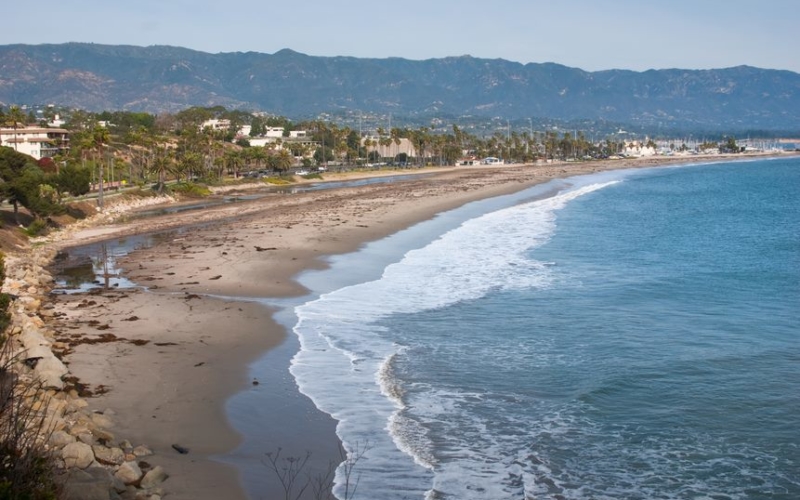
While Santa Barbara has experienced only small amounts of sea-level rise to date, the rate of sea-level rise in the region is projected to accelerate significantly in upcoming years. Over time, this will result in beach loss, increased bluff erosion, and intensified tidal and storm flooding in the low-lying areas of the City.
Predicting the future rate of sea-level rise in any given area is very complex and based on a number of changing factors including: melting of the Antarctic ice sheet; thermal expansion of seawater caused by warming of the ocean; ocean circulation patterns; vertical land motion; and greenhouse gas emissions globally. The Draft Adaptation Plan follows State of California sea-level rise guidance for the Santa Barbara area, which recommends a cautious approach to modeling impacts using the following projections: 0.7 feet of sea-level rise at 2030; 2.5 feet of sea-level rise at 2060; and 6.6 feet of sea-level rise at 2100.
Given the difficulty in predicting when specific amounts of sea-level rise will occur, the Draft Adaptation Plan recommends a phased approach to planning for sea-level rise that includes monitoring shoreline conditions and actions to reduce vulnerabilities when specific sea-level rise thresholds are reached.
The plan provides detailed recommendations for necessary actions in the near-term (approximately the next ten years) and a structure for future decision-making in the mid- and long-term (beyond ten years). Some of the near-term actions recommended include:

- Developing a Shoreline Monitoring Program with other regional agencies.
- Increasing beach nourishment and formation of sand berms or dunes at East Beach, Leadbetter Beach, and Arroyo Burro Beach.
- Relocating or flood-proofing sewer mains and other infrastructure currently located along the Waterfront.
- Replacing the Laguna Creek Tide Gate and Pump Station that currently function to keep high tidal waters from flooding the low-lying areas of downtown.
- Raising the Harbor breakwater and groins, which protect the City’s Harbor, West Beach, and Santa Barbara City College; and help retain sand along Waterfront beaches.
- Modifying regulations to require additional flood proofing of new development and redevelopment in areas south of Highway 101 that could experience increased levels of flooding with sea-level rise.
The plan also recommends additional study of adaptation options for the City’s stormwater, wastewater, and water systems. The El Estero Water Resource Center is located on a site that is elevated above surrounding areas. The most pressing issue for the wastewater system in the near- and mid-term (approximately 30 years) will be impacts to the collection system that feeds into the El Estero Water Resource Center.
The public is encouraged to review and comment on the Draft Sea-Level Rise Adaptation Plan from August 11th to September 30th. During that time, City Commission and informational sessions will be held, beginning with a City Council Informational Hearing on August 11th at 2:00 p.m. A webinar is planned for September 24th during which the public can ask questions and provide comments on the plan. To view the Draft Adaptation Plan, provide input, sign up for notifications, or obtain current information on meetings, you can visit www.SantaBarbaraCA.gov/SLR or email SLRPlan@SantaBarbaraCA.gov.Contact: Melissa Hetrick, Project Planner
Phone: (805) 564-5470 ext. 4556
Email: Mhetrick@santabarbaraca.gov. Images of the areas potentially impacted by 6.6’ of sea-level rise if no action is taken are located at the following links: